01
Risks move across information silos, areas and teams.
Floods, fires, power cuts, accidents : each interact with their environment in ways that single models or passive reports do not predict.
Risk intelligence platform
Quetzal assembles teams, equipment and live data into one tool. It spots the incidents before they happen, and shows you the best course of action, so your team can act early. We provide the tool for risk prevention and emergency management.
LLM don't understand risks, reporting software don't integrate live data, current tools cannot assist professionals in the crucial part of their job.
01
Floods, fires, power cuts, accidents : each interact with their environment in ways that single models or passive reports do not predict.
02
Cameras, sensors, satellites and public data produce more than ever, and years of past incidents sit there. Only a fraction of their potential is currently used.
03
A risk analysis takes weeks, and is out of date if anything changes. The experts keeping the analysis current cannot be everywhere all at once. Professionals need tools to automate this.
Why Quetzal
Quetzal exists because disasters are not surprises. They travel along links that were there to see in advance, in a city or in a plant alike. We build the software that spots those links early and tell the teams so they can act.
The idea is the same at any size: see the terrain as it really is, find out how a problem would spread through it, and test every solutions to solve them. The heavy work is the software's job. The decisions stay with your people.
One failure, then four
The same story fits a factory or a whole city. It starts with a single power cut.
010 min
The grid drops. On its own, an inconvenience: the lights go off and a backup generator starts up.
022 hours
The generator was sized for an hour, not a day. When the fuel runs low, everything behind it is suddenly exposed.
035 hours
Pumps, cooling, phones: the equipment that keeps the place running all needed that power. One by one, they stop.
048 hours
Production halts, or a hospital goes dark. The small first failure has become the whole problem. Quetzal maps this chain in advance, so it never comes as a surprise.
A flood, a fire and a power cut are three different problems, but they all follow the same logic, a hazard interacting with vulnerable assets. Our state of the art engine can analyze different risks and situations on a single screen.
One city, three hazard families. The same engine reads all three.
A flood takes the low-lying part of town: pumps, ground floors, the roads out. The water is only the first thing to go wrong.
A fire at a plant forces a shutdown. The heat, the smoke and the lost output reach far past the fence.
A power station fails and everything wired to it follows: pumps, phones, cold storage, hospitals on backup.
You don't need new sensors or a data team. Quetzal works with what you already have and does the heavy lifting.
01
Quetzal connects to what you already have: sensors, cameras, weather, maps and public data, all in one place.
60+
live data sources, one screen
02
It draws on a huge library of real past accidents to recognise how one problem leads to the next.
500,000+
real accidents history from 85+ countries
03
It shows you what could go wrong next. Clearly, and early. To do something about it.
Days ahead
not after it happened
Software for the agencies that protect a territory, software for the operators that run a site, and a one-time study for teams that just need the analysis.
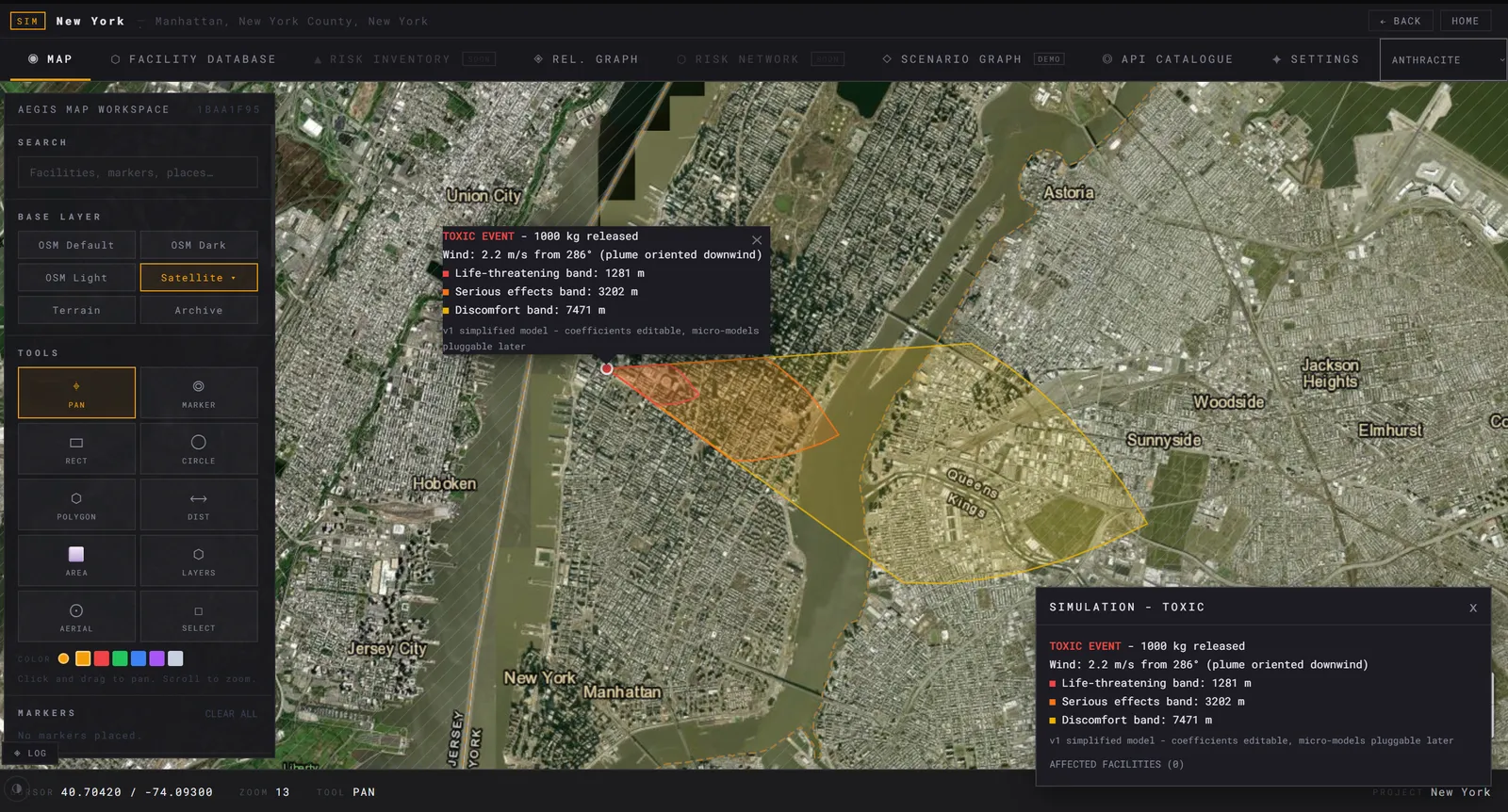
A real view from the platform: a chemical leak placed on the map, turned into the zones it would reach and the sites inside them.

Quetzal · risk intelligence